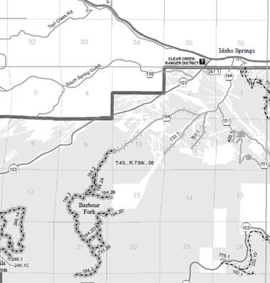
Barbour Fork Road Maintenance
Barbour Fork Road will be closed to all use from Aug. 18 to Aug. 24.
The Arapaho National Forest will be maintaining 1.79 miles of National Forest System Road 194.2 (aka Barbour Fork Road) to improve emergency vehicle access, watershed conditions, and recreational opportunities. It has been several years since the road has been maintained and it no longer meets Forest Service standards for a high-clearance road.
For other motorized road and trail opportunities, visit the USFS Motor Vehicle Use Map for the Clear Creek Ranger District or download the Avenza Map.
Explore More of Clear Creek County
Clear Creek County is the gateway to the Rocky Mountains. Located just west of Denver along Interstate 70, Clear Creek has 396 square miles of public lands to explore, as well as four mountain peaks above 14,000 feet. Clear Creek is comprised of charming mountains towns Idaho Springs, Downieville, Lawson, Empire, Georgetown, and Silver Plume, which are all along the I-70 corridor. Learn more about Clear Creek County here.